-
Email Us tours@rackinggorillasuganda.com
Embark on the ultimate Uganda safari experience that blends thrilling primate encounters with an exhilarating high-altitude hike in the legendary Mountains of the Moon. This 13-day journey takes you deep into Uganda’s most iconic protected areas, from the lush rainforests teeming with chimpanzees to the misty peaks of the Rwenzori Mountains, the savannah plains of Queen Elizabeth, the serene beauty of Lake Bunyonyi, the ancient home of mountain gorillas in Bwindi, and the picturesque landscapes of Lake Mburo.This action-packed itinerary is perfect for adventure seekers, wildlife enthusiasts, and nature lovers who want to combine chimpanzee tracking, mountain gorilla trekking, and a rewarding climb to Weismann’s Peak (4,620m) in the Rwenzori Mountains.
3 Star Hotel
Breakfast, Lunch & Dinner
4x4 Car
2-8
English
No Pets Allowed
8-100
Dry,Wet
Safari
Highlight; Start at Trekkers at 1,450 meters and sleep at Sine Hut at 2,596 meters being a height gain of 1,146 meters.
Today we start the hike to the mountains of the moon - Mt Rwenzori, the hike starts by walking to the valley floor encountering the afro montane forest zone with the chance to spot birds, monkeys like the colobus, L’Hoest, chimpanzees. You will be treated to beautiful sceneries of Enock’s Falls that is colse to Sine Hut Camp.
The Sine Hut Camp at 2,596 metres have wooden huts set between tall forest trees on a narrow ridge offering a good chance to view the spectacular Afro Montane forest and the Enock waterfalls that is few meters away. Overnight will be spent at Sine Hut Camp; or proceed to sleep at Kalama Camp at 3,134 metres, the advantage of staying at Kalama, is you get more time at Mutinda Camp where you may climb up to Mutinda Lookout at 3,975 metres with great views. Meals in the Mountain.
Day two on Mt Rwenzori Hike; Have a heavy breakfast and embark on the hike again, where you come to the Bamboo-Mimulopsis Zone; it’s a steep climb (In the wet season the bamboo zone is rather muddy and slippery making the going slow). Here the atmosphere and the forest is beautiful as you climb 551 metres altitude walking a distance of 1.8km to Kalalama Camp at 3,147 meters. The camp is in the Heather-Rapanea Zone, you are here to take a rest and a quick cup of tea/ coffee before heading on to Mutinda Camp. The trail meanders up and over several small knolls along a ridge top then drops down the side of the valley before climbing again, and in doing so cross several small streams and pass close to moss covered waterfalls. You then climb steadily along the side of a beautiful mossy river which tumbles down over the rocks under the Giant Heather trees whose trunks are covered in green moss with old man beards (Usnea lichen) hanging from the branches. The trail twists and turns as you climb up the deep valley, which has an enormous variety of plants and flowers. This valley is unique with many Giant Heather trees creating a beautiful atmosphere often shrouded in mist.
In the afternoon, you may climb up to the top of the Mutinda Lookout (one to two hours up and one hour down) The views are amazing as you stand on moss covered rocks at 3,925 meters with views across the Rwenzori Mountains and down to Kasese town and Lake George.
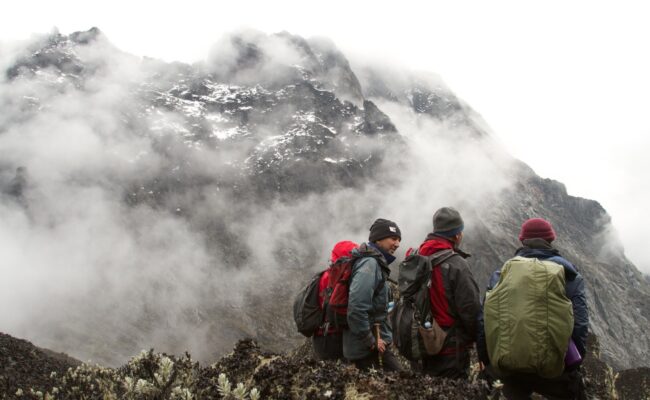
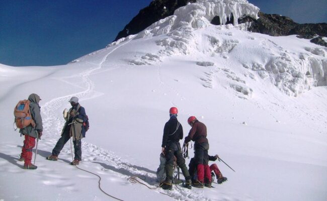
Third day on Mt Rwenzori, it’s a 4.9km starting at 3,688 meters climbing to 4,062 meters
Today, cross the Mutinda valley through the tussock grass and everlasting flowers interspersed with many Giant Lobelias before climbing a steep section up to the Namusangi Valley (3,840 meters), which ends abruptly with sheer waterfalls and fantastic views of Mutinda Peaks. The Namusangi Valley is wide, with many ups and downs and crossing several bogs as the trail climbs steadily to Bugata Camp at 4,062 meters. 
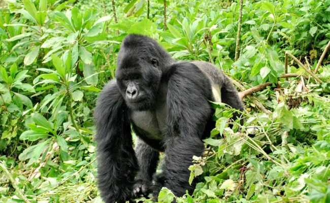
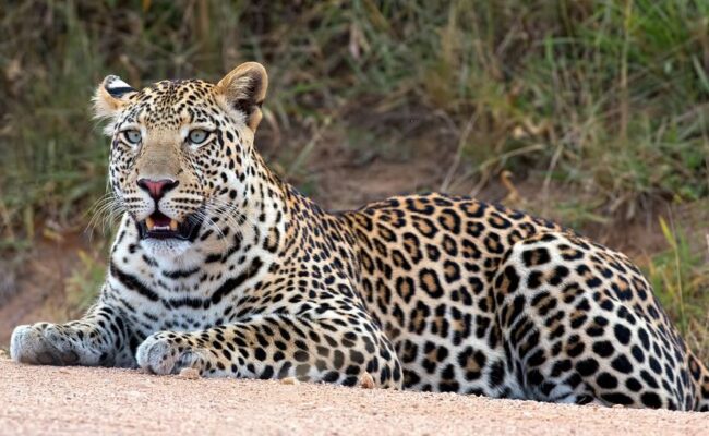
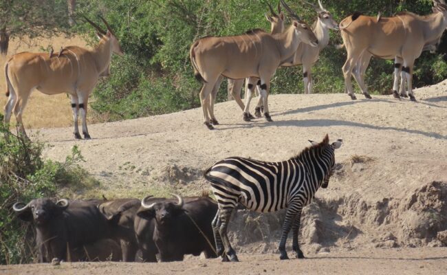
Bugata Camp is situated way up Bamwanjara Pass high above Bugata Lake with views across Lake Kopello to Weismann’s Peak, which is often covered with snow then down the valley views of Lake Africa and Lake Kanganyika and the many small peaks towards Mutinda Camp. The area is covered with tussock grass, everlasting flowers (Helichrysum), St John’s Wort (Hypericum becquaeritii), giant groundsel (Senecio adnivalis) and Giant lobelia (Lobellia gibberoa). There are a many Red Forest Duiker (Cephalophuc nigrifrons rubidus) a species endemic species to the Rwenzori Mountains.
Bugata Camp has good facilities, solar lights, good toilets and bathrooms where the guides may prepare some warm water in a basin for you to wash. Bugata also has a helicopter pad (GPS reading N 18.312 E29 53.457) in case of any need for rescue by helicopter but be warned that a helicopter in Uganda costs around $10,000 per hour flying time which is way more than other countries so you need insurance in case of rescue.
Hike to Weismann’s Peak 4,620 metres and Stella Peak 4,626 metres 3.7km to Weismanns Peak then another 800 metres to Stella Peak and return. Total distance 9km 4 to 6 hours
Fourth day on Mt Rwenzori, after breakfast start the hike by walking across the hillside below high cliffs above Bugata Lake then around a ridge point to Lake Kopello where we walk along the edge of the lake which according to researchers the water temperature averages 2˚C. the hike will offer beautifu views the four lakes along the valley below. The last section to the peak is steep on solid rock and can be difficult when snowing or iced up and it may be necessary to use ropes for safety. On a clear day you get awesome views of all the main peaks, Mt Stanley, Mt Speke and Mt Baker. The top of Weismann’s Peak is relativity flat or dome shaped with deep moss growing on the rocks creating a beautiful atmosphere. Stella Peak 4,626 metre is near Weismann’s but needs full technical skill as is dangerous and needs experience and a good head for heights. We do not advise crossing to Stella Peak
From the peak we descend directly to Kiharo Camp 3,460 metres down the Nyamwamba Valley. At the head of the valley there is a large area of thick Giant Groundsel with dense evergreen undergrowth and moss with the rocky peaks towering above which creates it’s own micro environment. As you descend the valley you will notice the terrain is made up of several flat boggy areas where millions of years ago glaciers sat and melted leaving a wall of big rocks in front of where it lay. The valley is home to many Red Forest Duiker (Cephalophuc nigrifrons rubidus).
You may opt to stay at Kiharo Camp at 3,460 metres an area rich in evergreen plants and babbling streams. Particularly during the dryer months the night the air is filled with the calls of the rock hyrax as they sit in the rocky cliffs high above.
Distance Kiharo Camp to the park gate 16km and another 2.8km down to Trekkers Hostel. 5 to 8 hours
Last day of the hike, descend to Nyamwamba Valley which has stunning views. A few kilometres from Kiharo Camp the path turns off to the right to pass along the river. You may spot Red Duiker quietly feeding as you pass along the river. After the waterfalls we climb up and over a high ridge then down though the dense forests with stunning views of the valley below. We stop at Forest View Camp for lunch before proceeding back to Base Camp. A great experience and ending to a fantastic trek.
Proceed to Queen Elizabeth National Park, for dinner and overnight at Elephant Plains/ Mweya Safari Lodge. FB
A curated list of related travel packages based on different destinations.
+256782554763
tours@trackinggorillasuganda.com
+256782554763
Accepted Payment Methods :